History
“LANDY” stands for Land Cover Dynamics, the core product of MapBiomas Indonesia that presents annual land cover dynamics across the country. LANDY adopts a satellite-based spatial monitoring approach developed by MapBiomas Brazil since 2015.
MapBiomas LANDY was first introduced in Indonesia through a collaborative effort of civil society organizations coordinated by Auriga Nusantara since 2017. The first product, Collection 1.0, was released on 10 November 2021, presenting land cover dynamics in Indonesia from 2000 to 2019. Collection 2.0, featuring 11 land cover classes on a year-by-year basis from 2000 to 2022, was released on 23 October 2023. LANDY is now in Collection 4.0, which includes 13 land cover classes with data coverage up to 2024 and will continue to be updated regularly.
Network
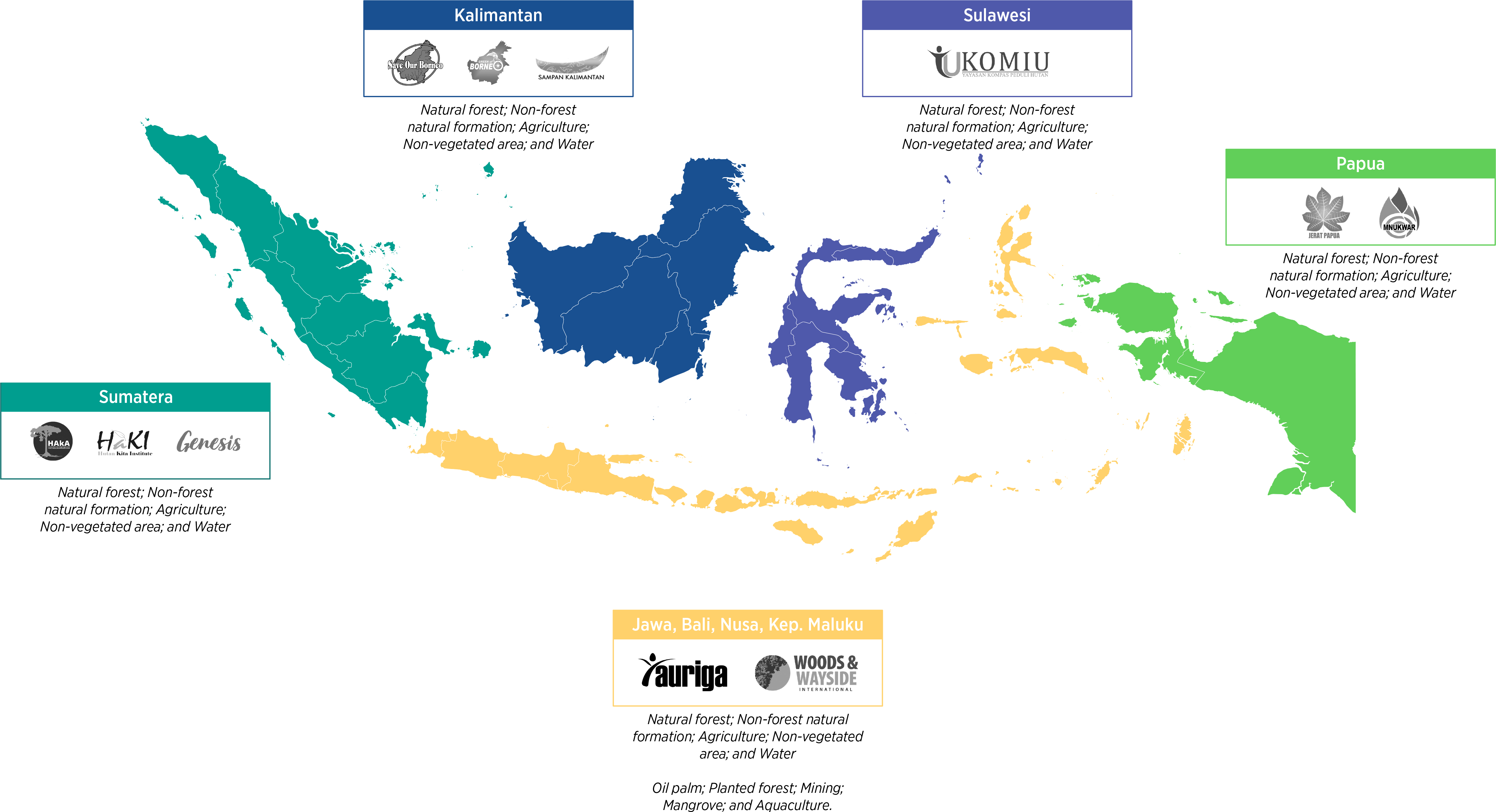
MapBiomas Indonesia is an Indonesian civil society network formed in an effort to encourage land cover transparency for the benefit of Indonesia’s people and natural environment. With its consideration for geographical representation making it a national initiative, the MapBiomas Indonesia network is made up of civil society organizations from Aceh to Papua.
The MapBiomas Indonesia network comprises HAKA Aceh, HAKI South Sumatra, and GENESIS Bengkulu from the Sumatra region; SAMPAN West Kalimantan, Save Our Borneo (SOB) Central Kalimantan, and Green of Borneo (GOB) North Kalimantan from the Kalimantan region; KOMIU Central Sulawesi from the Sulawesi region; MNUKWAR Papua and JERAT Papua from the Papua region; and Auriga Nusantara and Woods & Wayside International for the Java, Bali, Nusa Tenggara and Moluccas region. The network’s distribution is as follows:
In line with developments and needs, the MapBiomas Indonesia network is completely open to future expansion. The network has been developing collaboration with institutions of higher learning since the release of latest Collection, with 10 universities involved in testing the accuracy of Collection 2. It is within this framework that MapBiomas Indonesia is fostering intensive communications with various national universities and civil society groups.
Agenda Overview
Going forward, MapBiomas LANDY will continue to update Indonesia’s land cover data annually, expand its area of analysis, and improve both the resolution and accuracy of the data. LANDY will also strengthen collaboration with academia, civil society, and government institutions in developing advanced land-cover-based indicators and supporting cross-sector landscape change monitoring initiatives.
Contact
To communicate with MapBiomas Indonesia, please email us at contact@mapbiomas.id.